It was a good choice to wear long underwear, fleece pants, heavy socks, a hooded sweatshirt, and a stocking cap to bed. The overnight low was 41 degrees but I stayed warm thanks to being fully dressed inside my sleeping bag.
Boone camp setup.
Promptly upon crawling out of the tent we lit up the stove to boil water for coffee. The air was chilly but the skies were blue and sunny. With the coffee brewing in our coffee presses we redirected the stove’s output to making French toast and pepper bacon. The homemade bread Katie baked for us transformed into excellent French toast.
No artificial, high fructose corn syrup here.
After breakfast we pulled out the maps and guidebook. Using a photocopy of the map, we highlighted the route for the Snake Mountain loop. The start and finish of the ride was a parking area south of Todd, which looked easy enough to find. Todd is about 10 miles northeast of Boone.
We took our time cleaning up breakfast dishes, filling water bottles and getting dressed for the ride. Long sleeves and knee warmers were the plan given the temperatures in the mid to upper 50’s.
Havin' fun, but not smiling at the moment.
On the way out of Boone we stopped at the local bike shop Boone Bike & Velo. It was a very nice shop, selling mostly mid to upper end bikes. The shop was located just south of the Appalachian State University campus and there seemed to be a good stream of customers while we were there.
We met Shaw, the owner of the shop, who I had talked to on the phone several months ago about our upcoming trip. He gave me some good info about weather, camping, and routes when we talked. Later I discovered one of the routes in the guidebook was credited to Shaw.
Shaw asked about our plans for the day and we said Snake Mountain was on our radar. He said it was a good day for it, and he said the guidebook author was not exaggerating about the climb, it is steep.
Looking back down the Snake Mountain climb.
After two wrong turns we found the parking area south of Todd. It was becoming routine for us to require multiple attempts to find places while driving in the Boone area. We ate some lunch and assembled the bikes before setting our sights on Snake Mountain.
Prior to reaching the big climb we warmed up the legs with some switchbacks and climbing on the way to Meat Camp. Yes, the name of a town along the way is Meat Camp and the actual climb up to the pass near Snake Mountain is on Meat Camp Road.
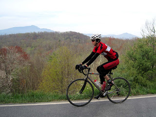
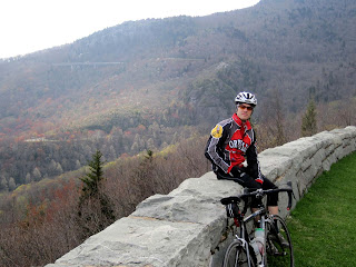
The climb began innocently enough with a left hand shift to the small chain ring. I recall a couple long straight-aways at modest grade and then the road steepened. At one point I thought it was time for another downshift but I was already in my biggest cog. I remember grinding for a little bit before deciding the rest of the climb would be out of the saddle. It was steep, that’s for sure. We reached the top of the pass and turned back around for some pictures of where we had just been. The view down to the valley from which we had just pedaled was pretty nice.
A nice view to the south.
What goes up must come down and we enjoyed a long downhill with Snake Mountain at our backs. It was easy to go 40 miles per hour without pedaling. Eventually the road flattened and we continued the loop around some tall mountains, including one 5000 footer named The Peak.
Somewhere along the way I saw a sign for Brew Bikes, a custom frame builder I’ve read about on the web. He offers hands on classes where you can build your own frame. I had to stop for a picture of his sign. I have to say it would be pretty neat to take a frame building class and end up with my own, custom built frame.
Brew Bikes, do a Google search.
There were at least a couple more good climbs on the way bike to the start, neither as steep as Snake Mountain but still good climbs that made us work for it. The roads were really low traffic and we commented on how many drivers waved at us. For a while it seemed as though every driver of an oncoming car we encountered would wave.
A typical view up the road.
Back at the parking area we ate some food and took our time getting back in the truck. It was nice to be on a lackadaisical schedule. On the way back to Boone we blasted the first Creed CD and enjoyed the short drive.
After a couple large pieces of lasagna and salad for dinner we logged into weather.com with the wireless connection at the campground. The forecast for the next several days was not looking good. Scattered showers thunderstorms were predicted for each day. It was disheartening to see the forecast, we drove too far for just a couple rides. Tomorrow morning the chance of rain was 30% through about lunch time when it increases to 80% or 90% by the afternoon.
With the aid of a lantern and headlamp we marked up a map for a ride tomorrow morning. We will try to do the Beech Ball loop, the route Shaw contributed to the guide book. The route starts and ends in Valle Crucis, circumnavigates Beech Mountain, and crosses over Georges Gap. Some of the climbs on this route were featured in the Tour du Pont in years past.
Our camp at night.
We'll be turning in for the night, praying for good weather tomorrow.


 T
T


